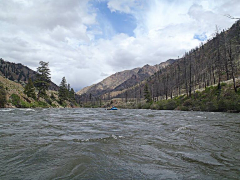
SF of Silver Creek is most well known for it’s more difficult upper reaches, but below Icehouse resevoir, there is a gorgeous, fun dramatic Class IV. With an average gradient of 70 feet per mile, several class IV rapids and literally miles of continuos Class III rapids through dramatic scenery, this should be a popular run, but hardly anyone has ever paddled it. It’s been choked by the dam upstream, and the stream bed is normally just a trickle. Last spring, rumours of water being released led a group of us to make the drive, but we struck out without water.
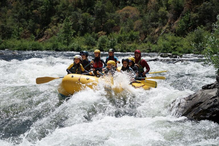
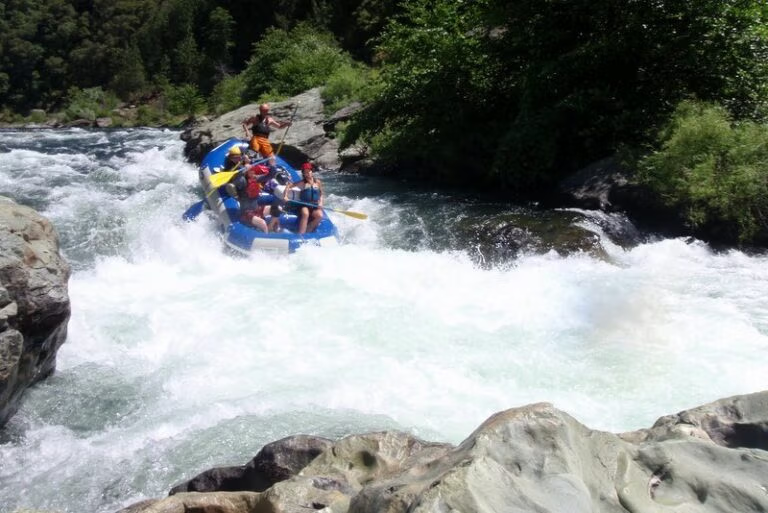
Last week there was a report that due to dam maintenece, there would be 400-600 CFS being released. Sounds like an expedition to me! I sent out an email to all the usual suspects, to round up a crew of experienced strong paddlers, and Saturday morning found myself at the Coloma Coffee shop, meeting Mike, Oliver, Mike F., Albert and Hilde. 40 miles later, we were at the river. Icehouse Reservoir is pretty, with large granite domes visible on the far side, but it was the river below that held our attention. We walked out on the dam, and looked down. For as far as we could see, it looked like a rapid. Fun! Water was blasting out of the dam, and sending an impressive spray into the air. Mike F. and I put in right at the dam, the others put in below that first rapid. The first rapid was class IV, not much chance to warm up. It required a careful peel out, followed by solid paddling to avoid being pushed into the trees on the right. It kept going.
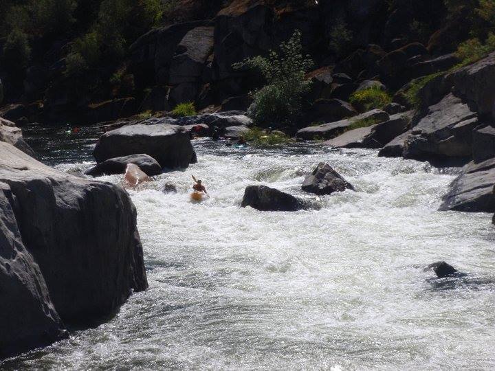
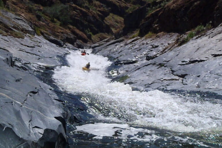
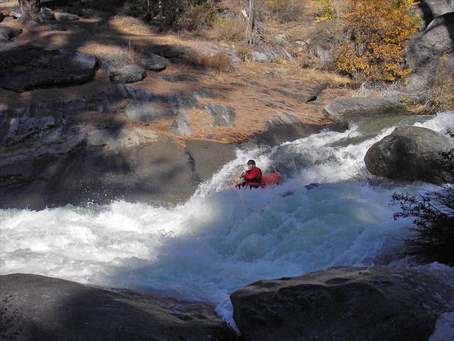
I won’t try and remember all the rapids in order. There were several significant rapids, including one or two that would be in the Class IV+ range, and several Class IV rapids. That said, I recommend this run only to strong class IV paddlers. Eddies are small, frequently in the bushes, and several of the rapids are long. There are also numerous, numerous logs that could prove to be serious hazards if paddlers aren’t careful, or if someone took a swim. We had 2 portages that everyone did, and several more that some part of the group did. At least one rapid caught 4 of us in a hole, though we all flushed after a round or two. The last small log jam, right by the bridge, we scooted around using a monkey walk, but word is that another group cleared that jam. Portages were all due to logs, some part of our group ran every rapid. Even with the hazards and logs, this is a great run, with fun paddling and nice scenery.
This is a great run. It’s a shame that it so rarely has water, and releases would be a welcome addition to the northern california boating scene. Regular release might clean up the run somewhat, especially the brushy banks. Consider watching the flows and catching it when you can.
Apparently, the flow was around 500 CFS the day we ran. Flows are supposed to continue until Nov 1, 2005.
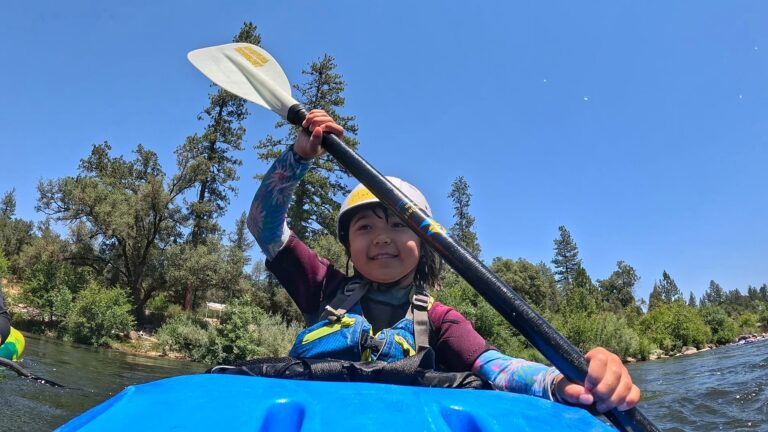
I had the chance to go run this creek again, Oct. 30th. It went well, we had a lot of fun with a strong group of paddlers. Reducing the “fear of the unknown” gave me better perspective on the difficulty, but I still think this Creek is a solid class IV, with potentially serious hazards. Super Super fun, and it’d be awesome to get regular releases on it! I didn’t take a ton of photos on my second trip, I was sort of in safety boater mindset, but there were a few good ones.
Hilde’s Directions
The run starts at the base of the dam at Ice House Reservoir.
Take HW 50 to Ice House Rd- put-in continue op the road to Ice House Resort-guessing maybe 8-10 miles up the road. Turn right onto Ice House-Wrights Lake Road and go to the dam/reservoir. Park here and walk down the service road to the put-in. Take your pick of where to put-in. The first rapid is kind of manky. An alternate put-in that cuts off a few miles of Class 4ish stuff is the Ice House Resort picnic area right on the road.
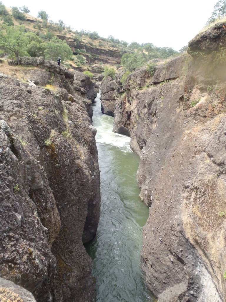
Take out-and this is from last year’s memory-take Peavine Ridge Rd which is about 2 miles or so from the HW-turn left-the only way to go-it is a paved big road-go about 3 miles to Road 31-turn right and go about 6 miles to Junction Res-or just before it-the bridge that crosses the road and Silver Creek. I wouldn’t suggest going all the way into the res as there are some log jams. A couple rapids right above the bridge are worth a look in terms of wood.
Ice House – South Silver Below the Dam · Oct 22 – Nov 3, 2005 📸